 The backbone of the Institute for Field Research is our accomplished Board of Directors. The IFR board conducts an annual peer-review of every single IFR field school to ensure that the highest quality of research and teaching is executed in each program. Our board members go above and beyond in their lives and careers, giving invaluable knowledge and support to the IFR, and to the larger archaeological community. A prime example of the work performed by this group of scholars, Dr. Fred Limp (founding IFR Board Member) will be offering a seminar through the SAA’s Online Seminar Series which provides free and fee-based professional development opportunities designed for students and archaeologists seeking to enhance their skill sets or knowledge base. The seminar will take place on September 19th, 2017 2:00-4:00pm. Cost per individual is $99 for SAA members/$139 for non-members and per group is $139 for SAA members/$179 for non-members. To register, please follow this link.
Seminar Title: “Beyond Mapping Grade – Using High-Precision GNSS Tools for Archaeological Site and Project Mapping”
Seminar Description: New developments in high precision GPS (also known as Global Navigation Satellite System or GNSS) systems now provide the capability to perform rapid (a few seconds per measurement) and precise (better than 5 cm) archeological mapping over large areas. Lower precision GNSS “mapping systems” have been long used to locate sites within a survey but these newer approaches can be used to provide detailed mapping of feature and architectural elements, individual artifacts, and other object locations. The new GNSS systems—often referred to as “real time kinematic” or RTK—can replace, or augment, traditional electronic distance measurement mapping tools and are especially valuable in sites that cover large areas. This online seminar will compare the traditional mapping grade systems with the new RTK based ones; review the strengths/weaknesses and cost/benefits of the systems; and provide specific high-precision workflows relevant to archaeologists. This course is designed for archaeologists with previous experience in mapping grade GNSS who are interested in improving the speed and precision of their mapping work.
Course Objectives:
a. Compare the traditional mapping grade systems with the new RTK based ones
b. Review the strengths/weaknesses and cost/benefits of the systems; and
c. Provide specific high-precision workflows relevant to archaeologists
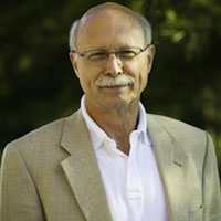
Instructor: Fred Limp has been involved in the applications of GPS (now GNSS) for more than two decades with experience in a wide range of navigation, mapping and survey GNSS hardware and software systems and with a special focus on archaeological and heritage applications. For 10 years he has taught advanced undergraduate and graduate courses in GNSS principles and applications at the university level. Recent applicable efforts involve detailed cost/performance comparisons of a range of systems and the development of workflows making GNSS, and especially high precision RTK solutions, more user friendly.